The sediment deposition near the Battle of Thermopylae, including around the Phocian Wall, is uneven due to the nature of the terrain and local water sources. This impacts how much sediment has accumulated on the ancient battlefield, affecting archaeological interpretation.
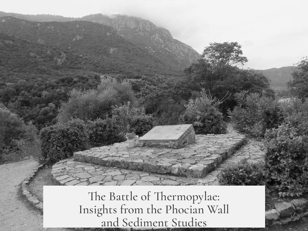
The Phocian Wall and the surrounding battlefield lie on a hillside slope bordered by a river, thermal springs, and a stream. These features influence sediment layers, which do not form a uniform blanket but follow the terrain’s contours.
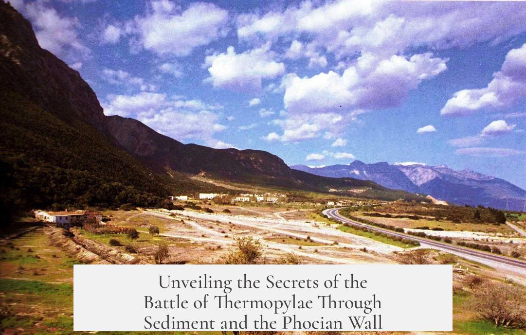
Alluvial fans and travertine deposits from mineral-rich springs primarily build up in basins previously occupied by sea and marsh. The hillsides where the wall stands have relatively less sediment due to runoff and slope, preserving much of the ancient topography.
A detailed 2010 geomorphological study clarifies these patterns. For example, an Electrical Resistivity Tomography (ERT) survey across a 235-meter line on the battlefield’s north side reveals distinct layers. Travertine deposits dominate the west, closer to the thermal springs, while silt accumulates more on the east side near marshland.
This study also reconstructs the ancient shoreline circa 480 BCE. It shows that what is now marshland was once a coastal zone, shaping the strategic placement of the wall and the battlefield’s layout.
The modern village lies near these deposits, emphasizing that sedimentation patterns have shifted the landscape over time. Researchers must account for these changes to accurately locate and study the ancient battlefield.
- Sediment deposits near Thermopylae vary sharply due to terrain and water sources.
- The Phocian Wall sits on a slope with limited sediment fill.
- Travertine and silt deposits differ by location, affecting archaeological layers.
- Ancient shorelines shifted, influencing the battlefield’s original environment.
- The 2010 geomorphological study provides detailed sediment maps and reconstructions.
Unveiling the Secrets of the Battle of Thermopylae Through Sediment and the Phocian Wall
Where exactly was the legendary Battle of Thermopylae fought, and how does the ancient Phocian Wall fit in? Could the sediment beneath our feet reveal clues about this historic moment? The answer lies in the fascinating interplay between geography, geology, and history.
The Battle of Thermopylae in 480 BCE is famously remembered for the heroic stand of 300 Spartans and their allies against the massive Persian army. However, pinpointing the battlefield’s precise location and understanding its terrain has long puzzled historians and geologists alike. Enter the Phocian Wall and sediment studies that bring clarity to this ancient mystery.
The Phocian Wall: More Than Just Stones
The Phocian Wall isn’t just a relic; it’s a key geographical feature lying along a hillside slope. Imagine a narrow corridor between a river and thermal springs on one side, and a stream on the other. The battlefield was squeezed into this uneven terrain, which naturally restricts sediment accumulation in the area.
Why does the limited sediment matter? Because sediment serves as a geological fingerprint. Where and how sediment builds up tells us about ancient landscapes, shorelines, and environmental conditions.
Sediment Deposits: Nature’s Uneven Painter
One might imagine sediment laying down a smooth, even carpet over the centuries. But nature prefers to mix things up. Alluvial fans and mineral springs deposit sediment by following existing terrain features, creating a patchwork rather than an even blanket.
This means some spots have thick sediment layers, while others have barely any. Around Thermopylae, the deposits are quite limited near the Phocian Wall and the battle zone because of the slope and the streams flanking the area.
Interestingly, the filled-in sections are mostly in the basins, places where seas and marshes once dominated. These basins have accumulated more sediment over time, transforming ancient shorelines into the landscapes we see now.
2010 Geomorphological Study: A Snapshot of Ancient Landscape
For those craving scientific insights with a modern edge, the 2010 geomorphological study provides an engaging and detailed look at Thermopylae’s terrain. Here are some highlights that illuminate the sediment question:
- Alluvial Fans and Travertine Locations: The study’s maps indicate alluvial fans created by flowing water and travertine deposits (a form of limestone from thermal springs) framing the battlefield. The Phocian Wall’s remains sit snugly within these features, giving us a clear idea of its spot on the hillside, near the current village.
- Uneven Sediment Distribution: An electrical resistivity tomography (ERT) section, which is a geophysical method, traces sediments along a 235-meter line on the battlefield’s northern edge. Travertine fills the western side, while silt dominates the eastern part. This variation underscores how water springs and streams shaped the sediment landscape.
- Ancient Shoreline Reconstruction: What’s particularly striking is the study’s reconstruction of the shoreline around the time of the battle, approximately 480 BCE. It reveals marshy areas bordering the battlefield and situates the Phocian Wall close to these wetlands, explaining the limited sediment buildup in this strategic pass.
What Does This All Mean For Our Understanding of Thermopylae?
First, it challenges the simplistic image of the battlefield as a flat choke point. Instead, the evidence points to a dynamic hill slope flanked by waterways and thermal springs. This terrain shaped the battle tactics and how both sides navigated the landscape.
Second, it sharpens the location of the Phocian Wall, showing it wasn’t just a defensive structure but part of a complex landscape involving natural barriers created by water and sediment patterns.
Third, the sedimentation patterns explain why sediment is uneven around the battlefield. This refutes claims that heavy sediment deposits have buried ancient features deep underground and suggests that the terrain preserved some original characteristics for centuries.
Getting Practical: Why Should You Care?
If you’ve ever visited Thermopylae or plan to, understanding this layered history adds depth to your experience. Standing near where the Phocian Wall once defended Greece gains new significance. You’re not just walking on hallowed ground; you’re moving through a geological archive that tells a story beyond the swords and shields.
For history buffs, archaeologists, and geology fans, this intersection of sediment and battle history offers a compelling narrative of how natural forces shape human events.
Explore Further: Accessing the 2010 Study
Hungry for the detailed science behind these insights? The full 2010 geomorphological study is available free online. It includes vivid illustrations and technical data for those wanting to dig deeper or verify interpretations. It’s a reminder that history and science are great partners in unraveling mysteries.
Final Thought: The Sediment Question Leads Us Beyond the Battle
The Battle of Thermopylae is often told as a tale of heroism and strategy. But geo-science introduces a new angle—highlighting how sediment patterns and landscape shaped that history.
Would the battle have unfolded differently if the terrain were flat? Would the Phocian Wall have been built in another place if the shoreline and streams weren’t there? These are questions where geology and history dance together.
So next time you hear the story of Thermopylae, think about the streams, springs, and sediments lying beneath. They aren’t just dirt and stones; they’re clues that help us rewrite history with real ground beneath our feet.
What does sediment deposition tell us about the Battle of Thermopylae site?
Sediment layers at Thermopylae are uneven, shaped by terrain and water sources. This uneven distribution means the battlefield and Phocian wall area had uneven sediment buildup, reflecting natural features like slopes and streams.
Where was the Phocian wall located in relation to natural features?
The Phocian wall stood on a hillside slope, between a river and thermal springs on one side, and another stream on the opposite side. This location limited sediment deposits around the wall and battlefield.
How did the 2010 geomorphological study illustrate sediment patterns?
The study showed locations of alluvial fans and travertine near the battlefield. It also used electrical resistivity tomography (ERT) to reveal uneven sediment layers, and reconstructed the shoreline from around 480 BCE.
What kinds of sediment dominate the battlefield area?
On the west side of the studied section, travertine deposits from thermal springs dominate. To the east, silt deposits prevail. This mix shows natural variations in sediment types around the site.
Why are the basins near Thermopylae important for understanding sediment deposits?
The filled basins used to be sea or marsh areas. Their infill affects how sediment has accumulated, offering clues about ancient landscape changes during the time of the battle.