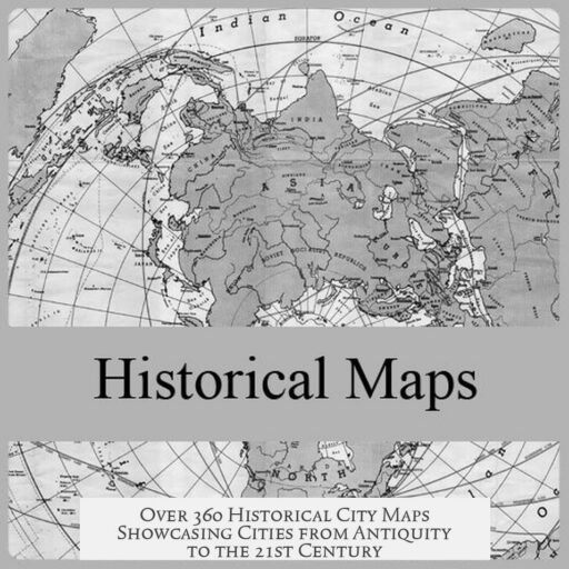
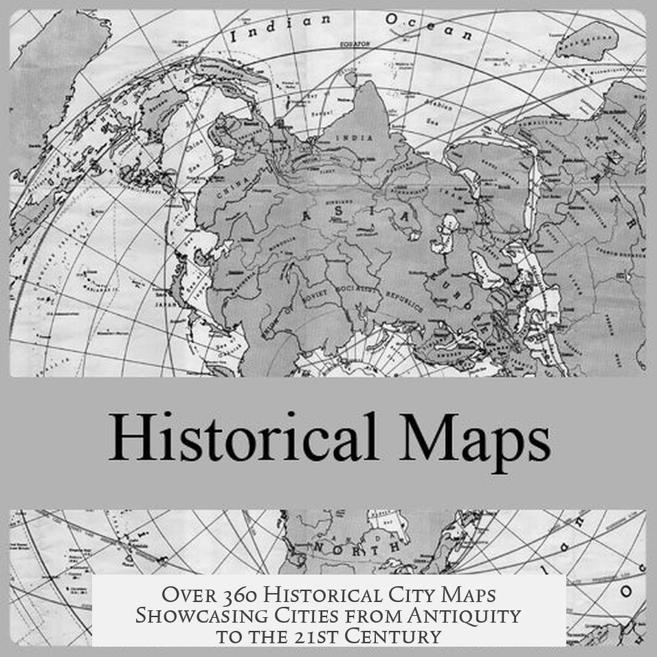
Here’s a collection of over 360 historical city maps and illustrations gathered from /r/papertowns, portraying many of the world’s cities from antiquity through the 21st century. This extensive resource covers cities from various continents and time periods. It serves as an invaluable tool for historians, educators, artists, urban planners, and enthusiasts interested in the development of urban landscapes.
The collection spans ancient settlements to modern metropolises. It displays the evolution of urban form, architecture, and geography. Many maps are bird’s-eye views, some with artistic embellishments. Various cities—like London, San Francisco, Paris, and Beijing—are well represented across different eras. Users can trace city growth, observe architectural styles, and study historical events as depicted in these maps.
Organized and formatted carefully, the maps are accessible for viewing digitally. Most images are high resolution, suitable for zooming or printing for personal or academic use. Users discuss whether printing quality meets professional standards, generally confirming images are clear enough for display. The collection often links to external sources such as the Library of Congress, which provides large, zoomable perspective maps, enhancing research possibilities.
Copyright and usage rights vary, but many maps can be used in educational contexts and personal projects, including student artwork. Community discussions highlight these aspects, emphasizing ethical use. The maps serve as both historical documents and inspiration for creative work. For example, role-playing game enthusiasts (like Dungeons & Dragons players) laud these maps for helping build believable cityscapes. Educational settings benefit by showing urban development trends and historical city defense strategies.
Many users note specific insights from the maps. Some highlight corrections to commonly held views, such as a Hangzhou map depicting content from an earlier era than its publication date suggests. Others reveal the addition of artistic features for aesthetic or functional reasons, like fortifications painted into maps where none formally existed. These nuances remind users that historical cartography blends fact with the mapper’s interpretation.
Unique city anecdotes enrich the collection’s appeal. One user mentions their son’s excitement over Constantinople from a popular children’s book. Another points out Bergen, Norway’s map, where a palisade was artistically added though no evidence supports its presence. A map showing London’s Great Fire of 1666 graphically depicts flames, capturing the historical moment vividly.
The community plays a dynamic role in expanding the collection. Users offer maps of additional cities, such as Kyoto, Paris in 508 AD, and Erbil in Kurdistan. Requests for missing maps include Munich, Braunschweig, and regions in Pakistan. Some contributors provide links to unique local archives, expanding the diversity and richness of the dataset. This collaborative approach broadens geographic and temporal coverage continuously.
Artistic and cartographic notes reveal how some maps received modern digital enhancements, improving image clarity. Recognized artists like Jean-Claude Golvin contributed detailed architectural reconstructions from antiquity. Map styles vary widely, reflecting cultural differences in cartography. For example, some Chinese city maps adopt European perspectives, while others use traditional Chinese visual languages. These differences help scholars understand intercultural influences in mapmaking.
Personal reactions from users demonstrate the collection’s impact. Many describe hours of immersive discovery. Some use maps as wall art or wallpapers, celebrating historical aesthetics. Others find nostalgic value in viewing cities where they live or once visited. The collection deepens appreciation for urban history and cartographic art, turning maps into a source of inspiration and education.
Some individual city highlights from the collection include:
- San Francisco in 1912, illustrating the Panama-Pacific Exposition during the World’s Fair.
- Stockholm in 1642, preserved in detailed public-domain imagery.
- Bergen, Norway, notable for mapped fortifications.
- Batavia (Jakarta) in 1667, providing insight into Dutch colonial city planning.
- Historic Seoul and Korea, featuring palace complexes historically significant to the region.
- Kuwait in 1952, showing early urban development post-World War II.
Overall, this comprehensive collection embodies a wealth of cartographic history. It documents urban evolution, architectural styles, and societal changes over centuries. The maps serve multiple purposes: visual history, educational tools, creative inspiration, and artistic expression. Availability of high-resolution versions and community collaboration ensure accessibility and ongoing enrichment.
This collection invites users to explore cities through time, connecting past and present visually, fostering curiosity about human settlements and their stories.
Key takeaways:
- Over 360 historical city maps span from antiquity to the 21st century, covering diverse global cities.
- High resolution and organized format allow detailed study, printing, and educational use.
- Maps provide insights into city development, architecture, historical events, and urban defense.
- Artistic liberties often influence map details; understanding these helps interpret historical context.
- Community contributions expand the collection continuously, adding rare and regional maps.
- Maps serve varied interests: historians, educators, artists, game designers, and urban planners.
- Personal engagement with maps fosters appreciation for cartography and urban heritage.
Here’s a Collection of Over 360 Historical City Maps and Illustrations That I’ve Gathered from /r/papertowns, Portraying Many of the World’s Cities from the Times of Antiquity to the 21st Century
If you love history, cartography, or just plain cool visuals, this collection is your new best friend. Imagine peeling back the layers of time by scanning over 360 meticulously assembled maps and illustrations, stretching from ancient cities to the modern metropolises gracing our planet today. This vast archive from /r/papertowns offers a unique glimpse into urban evolution like you’ve never seen before.
But what makes this collection truly special? Let’s dive into the details.
Immense Scope and Timeless Appeal
This isn’t your average map gallery. The sheer scale covers many of the world’s iconic cities—Rome, London, Constantinople, and up to 21st-century skylines like San Francisco and Chicago. Each map shows cities during different eras, capturing urban life from ancient bazaars to bustling industrial expansion. From the majestic city plans of antiquity to detailed 1912 views of San Francisco with the Panama Pacific Exposition, the collection spans millennia.
It transcends borders and continents, showcasing cities as diverse as Bergen in Norway, mapped by Hieronymus Scholeus with some artistic guesses about city defenses; to Hangzhou, China, dating back to the 1200s but rendered through a European cartographic lens. Curious about Paris as it was in 508 AD? Or how Nancy, France, resembled a fantasy setting in 1645? This assortment has got you covered.
Why Should You Care?
Whether you’re a historian, educator, urban developer, game designer, artist, or just a curious soul, these maps are packed with insights. Ever wondered how neighborhoods evolve over centuries? Take Madrid: some parts of the modern city simply didn’t exist 400 years ago. Or think about a DnD enthusiast looking for authentic city layouts to inspire a campaign—these maps serve as rich templates.
Even scholars note how these “bird’s-eye” views often included artistic liberties. Buildings magically appeared where there was empty land, just because it looked better. It’s like the original city planners had Photoshop before Photoshop existed.
Quality and Usability: More Than Eye Candy
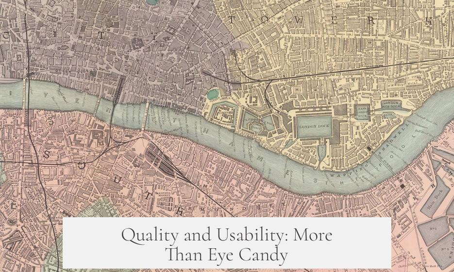
Let’s talk tech and practicality. Many users wonder if these maps are print-ready or usable for personal projects. Rest assured, the images are generally high-resolution, often zoomable, and some even derive from massive collections like those of the Library of Congress. So, yes, you could turn them into impressive wall art for your home or office.
Licensing and copyright are also a hot topic. The collection includes public domain works and other historically sourced images, making them safe for educational and private use. Teachers have found the images invaluable in classrooms, illustrating urban development and historical events vividly. Creative uses? Absolutely — from student artwork to role-playing environments and editorial projects.
Stories Behind the Maps: Human Touches and Historical Quirks
Maps are not just technical documents; they narrate stories. One Redditor’s son became enamored with Constantinople after seeing it referenced in a Dr. Seuss book. There’s serendipity in that kind of discovery. Another fascinating tidbit: the London 1666 map actually paints the Great Fire, hinting how cartographers combined art with documentation.
Some maps reflect quirky adjustments—like the Bergen map where the artist inserted a palisade because he thought the city deserved better defenses. It reminds us: old maps sometimes say as much about the mapmaker’s imagination as the city itself.
Community Contributions Amplify the Treasure Trove
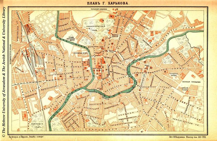
This isn’t a stagnant archive. Enthusiasts worldwide pitch in—offering maps from Japan’s Kyushu in the 17th century, ancient Erbil in Iraqi Kurdistan, or a Kuwait development map from 1952. The community corrects errors too. For example, a noted slip swapped an Edinburgh map with Syracuse, New York!
Where else can you find such collaborative spirit around cartography? The collection encourages contributions, expanding with diverse geographic and historical breadth. It’s like an ever-growing digital museum curated by passionate map lovers.
Artistry, Cartographic Techniques, and Style Wars
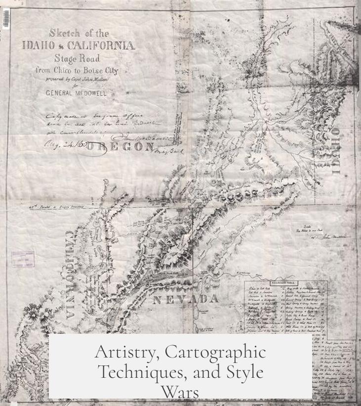
Forget dry, boring maps. Many of these illustrations are works of art. Some were painstakingly recreated by notable cartographers like Jean-Claude Golvin, who spent decades drawing ancient cities. This art plunges viewers into Roman Tages or Ancient Lugdunum with immense detail.
The styles vary drastically. Some maps carry European flourishes even when portraying far-flung Asian cities, indicating how cultural perspectives influenced representation. Moreover, early maps often feature buildings packed onto bridges, a historical oddity revealing construction customs of old times.
Modern digital touch-ups have cleaned and enhanced some maps, such as the 1912 San Francisco or Austin illustrations, blending old world charm with clarity. Just don’t trust these cartographers too much—they do say “they’re always plotting.”
Why This Collection Inspires Enthusiasm and Nostalgia
People don’t just appreciate the collection—they fall in love with it. One user admits to literally “getting a boner” over the maps, a testament to their visual impact. From decorating walls with an Augusta Raurica map to using images as wallpapers in favorite bookstores, the emotional connection is palpable.
Many have spent hours lost in study, finding places close to home or cities they once visited. There’s something magical about seeing your own neighborhood emerge centuries ago or observing fantastical designs reminiscent of epic stories.
Highlighting Some Noteworthy Maps and Links
- San Francisco 1912: This map features the Panama Pacific Exposition, a crowd-puller from the 1915 World’s Fair, symbolizing the city’s emerging global presence.
- Stockholm 1642: Check it out here: Historic Stockholm Map
- Batavia, Java 1667: Discover the Dutch East Indies’ capital with this detailed map: View Batavia Map
- Los Angeles 1894: Dive into this image illustrating LA’s early days: Old Los Angeles
- Kuwait Development Map 1952: Historical urban planning from the Gulf: Kuwait 1952
Why Aren’t You Already Digging Into This Collection?
Finding a single source with such diverse and exquisite maps is rare. But here, you not only get quantity—you receive context, community contributions, artistic insights, and practical usage tips. It’s a map lover’s paradise that makes historians grin, city planners ponder, and artists sprint to their sketchpads.
So, whether you want to wallpaper your computer with antique London, study urban growth for school, or dream up fantasy worlds for your next game session, this rich archive delivers everything you need. Never underestimate the power of maps—they don’t just show places; they tell stories of human ambition, art, and culture across centuries.
“This is gonna be great for my DnD city building. Thanks.” – An excited gamer
And if you’re worried about information overload? Don’t be. The maps are neatly organized and categorized, allowing easy navigation and focused study. Plus, digital zoom lets you examine waves of medieval rooftops or intricate fortifications without squinting.
Ready to get lost in time and space? These >360 maps and illustrations from /r/papertowns are just waiting for explorers like you.