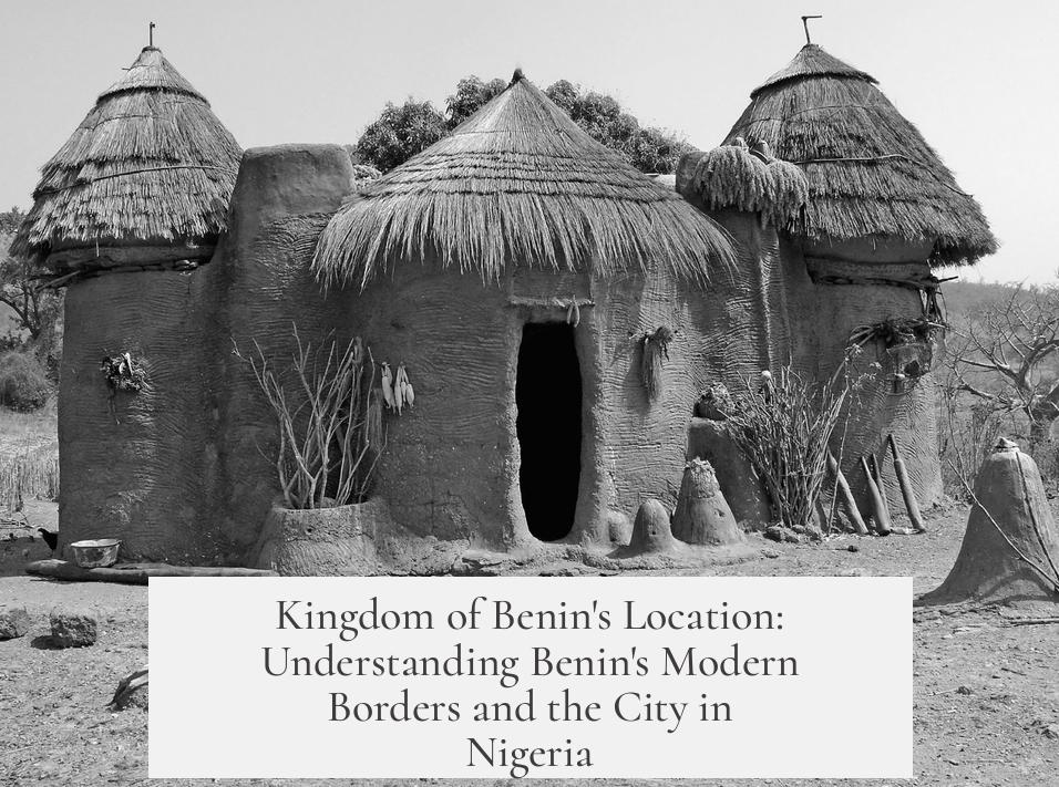
The modern country of Benin is not located in the territory of the historic Kingdom of Benin because its name derives from the Bight of Benin, a coastal geographic feature named after the kingdom, rather than the kingdom’s actual lands. Meanwhile, the city called Benin is in Nigeria, where the original Kingdom of Benin was based.
The Kingdom of Benin was a pre-colonial African state centered in what is now southern Nigeria. It controlled territory along the Atlantic coast near the Bight of Benin. When Europeans arrived and named this coastal region, they called the large bay the “Bight of Benin,” honoring the powerful kingdom. This geographic name would later influence modern national names.
The modern country called Benin lies on the Bight of Benin, but it is geographically distinct from the ancient kingdom’s territory. Originally named Dahomey after another kingdom, the country changed its name to Benin in 1975 following a Marxist coup. This change happened for political reasons: the ruling group avoided names linked to monarchy or traditional royal authority, opting instead for a name representing a broader, neutral regional identity.
The city of Benin, often called Benin City, sits within Nigeria and was the capital of the Kingdom of Benin. Its name and location directly connect to the kingdom’s historical lands. However, the country’s name “Benin” does not refer to this city or its territory but rather stems from the name of the coastal bight, which Europeans named after the kingdom but eventually designated as a broader maritime region.
- The Bight of Benin is a coastal feature named after the historic Kingdom of Benin in Nigeria.
- The modern country of Benin occupies territory along the Bight of Benin but not the kingdom’s original lands.
- Dahomey, the former name of modern Benin, was changed after a Marxist coup that rejected royalist names.
- Benin City in Nigeria is the original kingdom’s capital and bears its name.
Why Isn’t the Modern Country of Benin in the Territory That Used to Be Part of the Kingdom of Benin? And Why Is the City of Benin in Nigeria?
Here is the straightforward answer: The modern country of Benin is *not* geographically where the ancient Kingdom of Benin once thrived. Instead, the Kingdom’s heart is in present-day Nigeria, where the city of Benin stands. The modern country’s name came much later, from the Bight of Benin—a coastal feature named after that same historic kingdom.
Let’s untangle this fascinating historical and geographical puzzle together, step by step. Spoiler: it involves colonial maps, political revolutions, and a dash of Marxist skepticism for royalty.
The Kingdom of Benin Was Not in Today’s Benin, but Nigeria
The Kingdom of Benin was quite the powerhouse, reigning over a territory in what is now southern Nigeria. This kingdom, famous for its art, culture, and administrative sophistication, controlled land along the Atlantic coast during the age when European powers carved up Africa.
Yet, if you look at a map today, you won’t find the modern country of Benin in this area. Instead, you’ll find the city of Benin—the ancient kingdom’s capital—right there in Nigeria. This is where the kingdom’s epic heritage physically lies. So why the name confusion?
Geography to the Rescue: The Bight of Benin
Picture the African coastline curving down like an upside-down L. On this Atlantic edge, two prominent bays stand out: the Bight of Benin and the Bight of Biafra (sometimes called the Bight of Bonny). The modern Republic of Benin sits comfortably on the coast along the Bight of Benin, and its name is linked to this geographical feature rather than directly to the ancient kingdom.
Here’s the twist: the Bight itself was named after the Kingdom of Benin. European explorers and mapmakers in the colonial era tagged the bay with the kingdom’s name, signifying its influence and control over the coastal trade at that time. However, the actual heartland of the Kingdom was further east, within Nigerian borders today.
The Modern Country of Benin: A Name Born from Politics, Not Geography
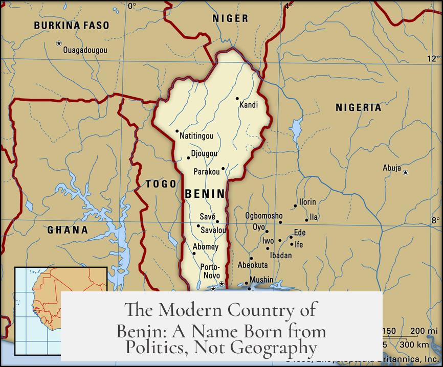
The Republic of Benin was not always called that. When it gained independence from France, it was known as Dahomey, named after the powerful Kingdom of Dahomey that dominated that region. Dahomey had its own rich history, distinct from Benin’s kingdom, but still very influential.
Enter a Marxist coup. The new rulers, eager to distance themselves from symbols of monarchy and old royal structures, found “Dahomey” too tied to royal tradition. So what to do? They reached for neutrality.
Why not rename the country after a geographic feature instead? That’s how the name “Benin” became the official title of the modern state in 1975. It referenced the Bight of Benin, a neutral, non-royal name that symbolized the coastal heritage without invoking old monarchies that Marxists opposed.
What About the City of Benin? Why Is It in Nigeria?
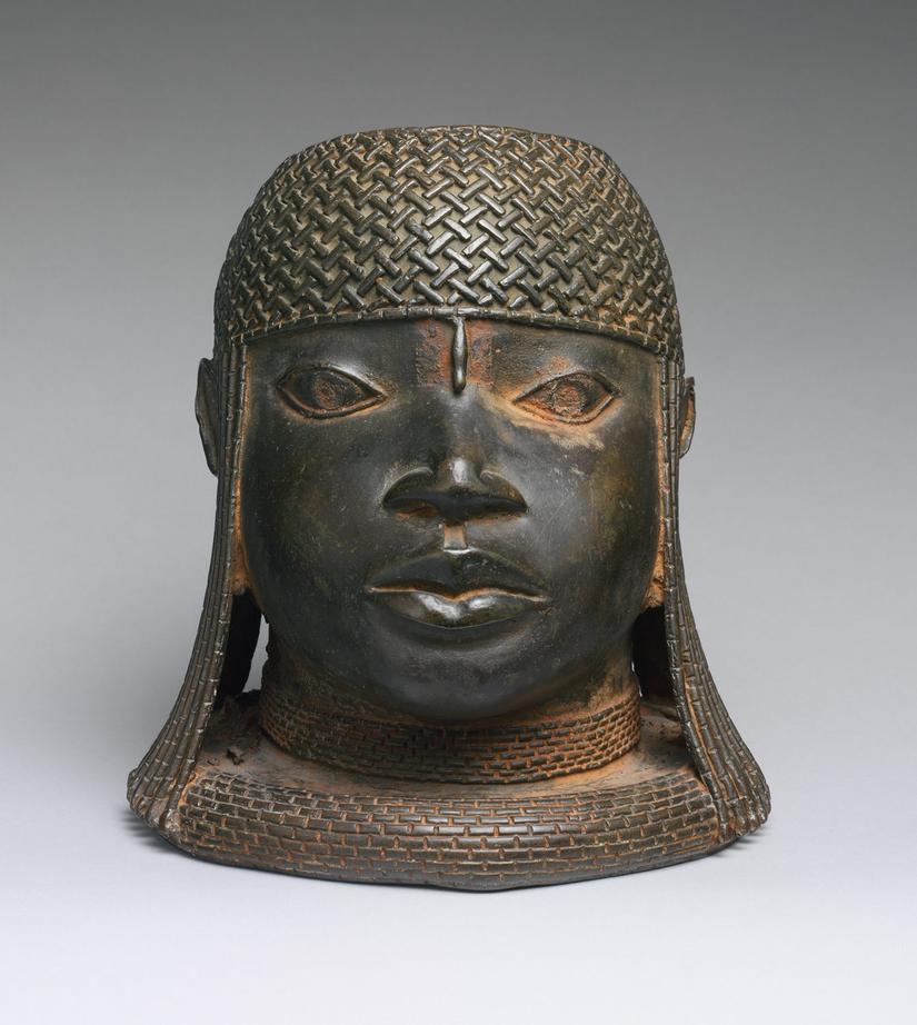
The city of Benin, often called Benin City, is the historic capital of the Kingdom of Benin. It thrives in Nigeria. This explains why modern Benin (the country) and Benin City don’t overlap geographically.
While the name “Benin” appears in both, the origins and contexts differ. Benin City holds centuries of art and history, famous for its bronze works and court culture. On the other hand, the country of Benin has its own identity shaped by colonial borders, revolutions, and pragmatic renaming.
A Story of Names, Borders, and History
Names often serve as bridges or battlegrounds for identity, history, and politics. The name “Benin” is a prime example. European colonialists mapped and renamed the African coast, often ignoring existing ethnic boundaries and allegiances.
The Kingdom of Benin’s influence stretched over coastal regions, so Europe named the Bight after it. But the kingdom’s core land ended up inside Nigeria’s modern borders, shaped by colonial agreements the locals had little say in.
Meanwhile, the country that would become the Republic of Benin was known as Dahomey—a name attached to a kingdom south of Benin’s. When Marxists took over, royal names were out. A neutral geographic catch-all, “Benin,” from the Bight, made political sense.
Why Does This Matter?
You might wonder, why should all this naming and geography confusion even matter? Because it reflects how colonial histories, politics, and culture shape modern nations. It teaches us not to oversimplify Africa’s vast historical tapestries. Borders and names on maps didn’t always follow people’s histories or identities.
Plus, it’s a cool mind-bender for geography buffs! How many countries are named after a coastal feature that itself honors a kingdom located *elsewhere*? Not many.
Lessons & Takeaways
- Political shifts shape names: The Marxist coup in Dahomey reveals how ideologies influence national identity.
- Geography can mislead: The Bight of Benin gave the modern state its name, but the ancient kingdom was inland, in Nigeria.
- History matters: The Kingdom of Benin’s legacy lives on, not just in Benin City, but also in art and culture worldwide.
In the end, the answers to these questions about Benin’s name and location remind us how history, geography, and politics collide. And sometimes, those collisions cause the twisty stories behind names on the map.
Ready to Dig Deeper?
Curious how other African countries’ names came about? Wonder how colonial borders have shaped modern identities? Whether you are a history nerd, geography lover, or just like a good story with political intrigue—remember this tale of Benin next time you look at a map!
Why is the modern country called Benin if it is not located in the Kingdom of Benin’s territory?
The country of Benin is named after the Bight of Benin, a nearby coastal area. The bight itself was named after the Kingdom of Benin, but the modern country’s borders do not match the old kingdom’s territory.
Where was the Kingdom of Benin located?
The Kingdom of Benin was located in what is now southern Nigeria, controlling territory along the Bight of Benin when Europeans arrived.
Why is the city of Benin in Nigeria, not in the modern country of Benin?
The city of Benin is located within the area of the historic Kingdom of Benin, which is inside present-day Nigeria. This city retains the original name linked to the kingdom itself.
Why did the country of Dahomey change its name to Benin?
After a Marxist coup, the country formerly known as Dahomey changed its name to Benin. The new government avoided royal-associated names and chose Benin, reflecting the coastal geography instead.
Did the Kingdom of Dahomey and Kingdom of Benin overlap in territory?
No, the Kingdom of Dahomey was separate from the Kingdom of Benin. Dahomey was in the area of the modern country of Benin, while the Kingdom of Benin was in what is now Nigeria.